LandForm® X: ISR Mission Management System
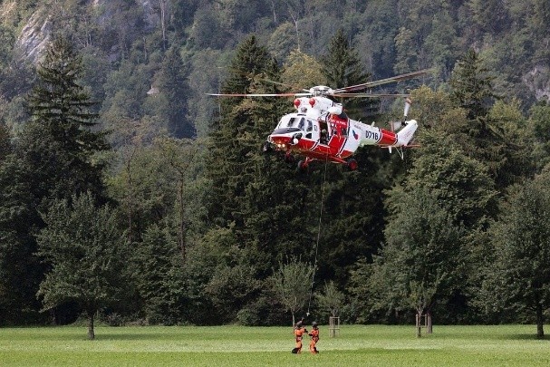
LandForm® X is an affordable, carry-on, ISR mission management system designed for airborne law enforcement, Search & Rescue, Wildfire Response, and other Intelligence, Surveillance, and Reconnaissance mission-sets. With a moving map, video player, target list, geospatial augmented reality, FMV annotation tools, DVR, and a user-friendly Android-based interface, LandForm® X empowers Tactical Flight Officers and Sensor Operators with a streamlined yet powerful Mission Management System.
What Is LandForm® X?
LandForm® X is a gimbal-agnostic Mission Management System designed for Intelligence, Surveillance, and Reconnaissance (ISR) operations. Built for portability, it operates seamlessly on an Android tablet or embedded chipset, providing Tactical Flight Officers and Sensor Operators with a carry-on solution for airborne ISR missions.
LandForm® X’s core capabilities include full sensor control with geopointing, a moving map, target list, geospatial augmented reality, FMV annotation tools, and a DVR. This comprehensive solution allows users to take their mission management system from aircraft to aircraft or even back to the office for detailed post-mission analysis, offering unparalleled flexibility. LandForm® X is an ideal choice for global ISR operations spanning airborne law enforcement, search & rescue, wildfire management, video production, and more.

Video Overview
LandForm® X Features
Product Specifications
Operating System
- Android
Hardware Options
- Tablet
- Monitor Backpack
- Traditional MMS Box
Sensor Connectivity
- WIFI
- Ethernet
Supported EO/IR Gimbals
- Multiple Major Platforms – Contact for Complete List
Video Formats
- MPEG 2/H.264
- MPEG/KLV – MISB 0601
- STANAG 4609
LandForm® X Mission-Sets & Use Cases
LandForm® X is a versatile mission management system designed to excel across a wide range of mission sets, delivering powerful tools for real-time situational awareness and operational efficiency.
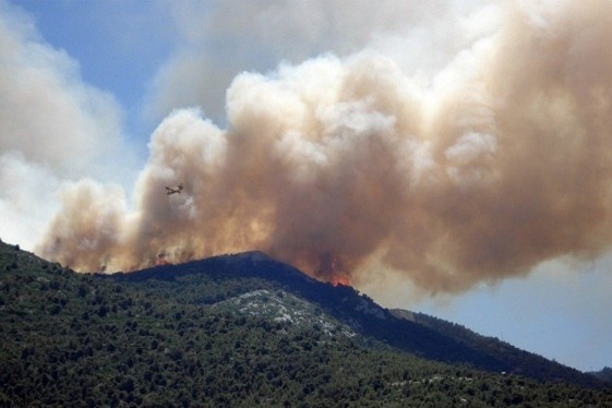
Its comprehensive feature set makes it an invaluable asset for Airborne Law Enforcement operations, aiding Tactical Flight Officers in tracking and responding to incidents with precision. In Infrastructure Inspection and Maritime Surveillance, LandForm® X streamlines the monitoring of critical assets and vast areas, providing actionable insights. Its capabilities are equally effective in Search and Rescue missions, where rapid geospatial awareness can save lives, and in Wildlife and Wildfire Management, enabling efficient tracking of species or coordinating firefighting efforts. Even in creative fields like Video Production, LandForm® X enhances storytelling by offering precise mapping and video annotation tools. This adaptability ensures LandForm® X meets the demands of diverse missions.


Explore Related Products And Solutions

BlueFly®: Drone-Mounted Bluetooth For Search And Rescue
BlueFly® is a state-of-the-art detection device designed to enhance search and rescue operations.

TAKaaS℠: TAK Integration, Training, And Support For Mission Success
TAKaaS is a service that harnesses the full potential of the TAK (Tactical Assault Kit/Team Awareness Kit) ecosystem.

Cyber And Intelligence
We support cyber operations worldwide with leading-edge technical innovations, mission planning and automation solutions, cyber threat intelligence, and advanced cyber threat hunting and incident response.

Advanced Military Cyber Training In The Information Environment
We provide technical and operational services and training and readiness solutions to public and private enterprises.

Space Solutions
Explore our history in launch logistics, ground control, satellite operations, assured positioning, navigation, and timing (PNT), domain awareness, and geospatial intelligence.

Artificial Intelligence
We’re harnessing the potential of artificial intelligence (AI) to transform the way government and commercial industries operate.
Learn more about LandForm® X.
Contact us today to learn more about our affordable, carry-on, ISR mission management system.
Request Info