Drone Inspections, Environmental Monitoring, And Mapping
The use of drones is taking off—and for good reason. The range, stability, and precision of drones—also called Small Unmanned Aircraft Systems (sUAS)—are a boon to all industries benefiting from remote sensing technologies. Drone mounted sensors help save time, cut costs, and improve safety, especially during inspections. Moreover, sUAS capture imagery and other types of data are invaluable to design, planning, and project management.
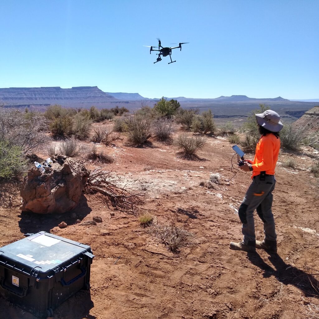
We operate an industry-leading aviation-based sUAS program. Our pilots are Federal Aviation Administration (FAA) and Transport Canada–certified and trained by experienced instructor-pilots who oversee mission training and qualifications for our staff.
With a focus on safety and capabilities in digitally enabled mapping, inspection, and environmental solutions, our drone program delivers.
Our teams can quickly deploy and fly drones over hundreds of acres with ease and have experience operating in mountainous corridors and highly congested airspace. From civil to defense projects, we have the equipment and experience to meet your needs.
We use drone imagery and light detection and ranging (LiDAR) to generate maps and models to be integrated into computer-aided design (CAD), building information modeling (BIM), or geographic information systems (GIS) and other design applications. The processed drone data is used for everything from storm-surge modeling to reality models for complex construction design and phasing. Rapidly generated maps allow us to track construction progress and calculate productivity based on measurements derived from produced models.
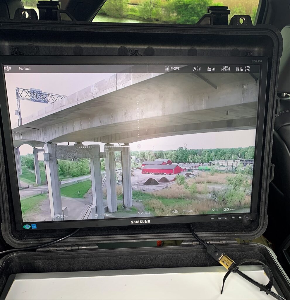
We use drones to manage risk during inspections in a broad range of industries and capture data in hard-to-access locations such as towers, bridges, industrial facilities, buildings, and roadways. By using zooming cameras, thermal sensors, and autonomous drones, we perform inspections both up close and from a distance.
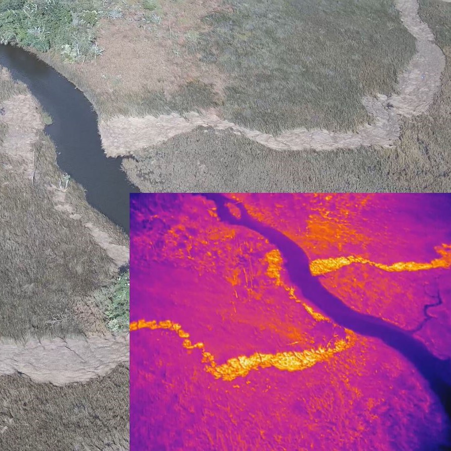
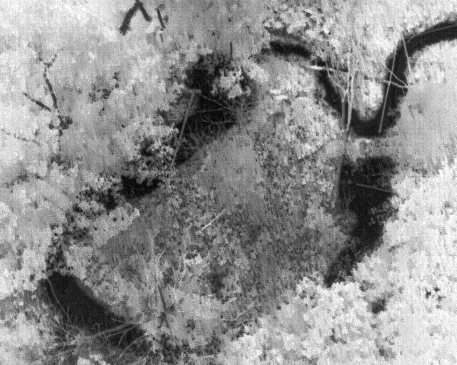
The data we capture with drones creates a more sustainable future.We assess environmental conditions such as water quality in difficult to reach areas, conduct artificial intelligence-based traffic analysis prior to recommending the expansion of roadways, locate orphaned oil wells via drone-mounted magnetometers and other payloads, and find unexploded ordinance to tag and remediate.
-

- Our drone team flies in all types of locations from busy cities like New York City to the quiet forests of the midwest on many different types of projects.
-
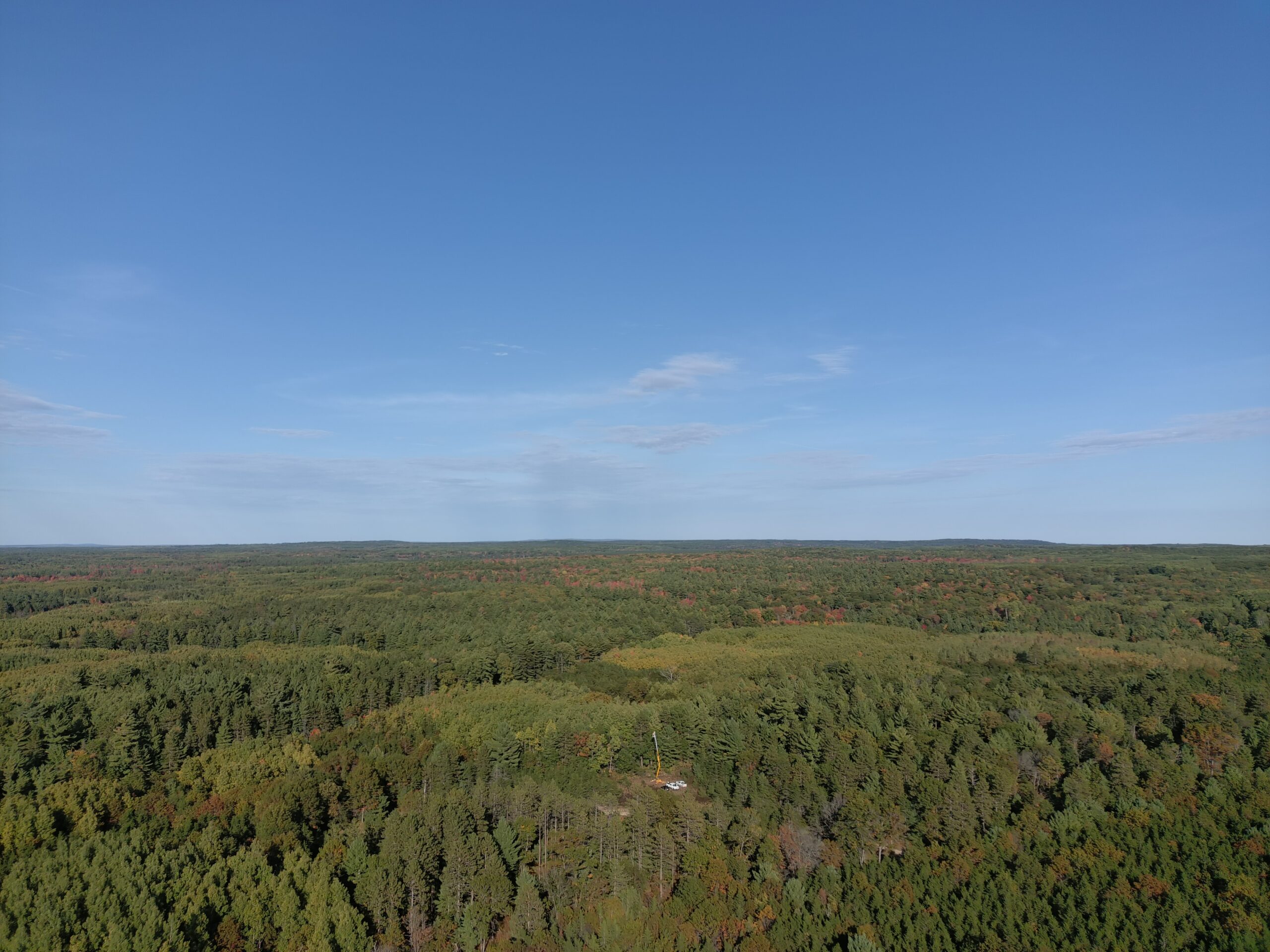
- Our drone team flies in all types of locations from busy cities like New York City to the quiet forests of the midwest on many different types of projects.
-
- Each drone team has varying needs and therefore, a complement of sensors including cameras, multispectral, thermal, LiDAR, and magnetometers are used.
-
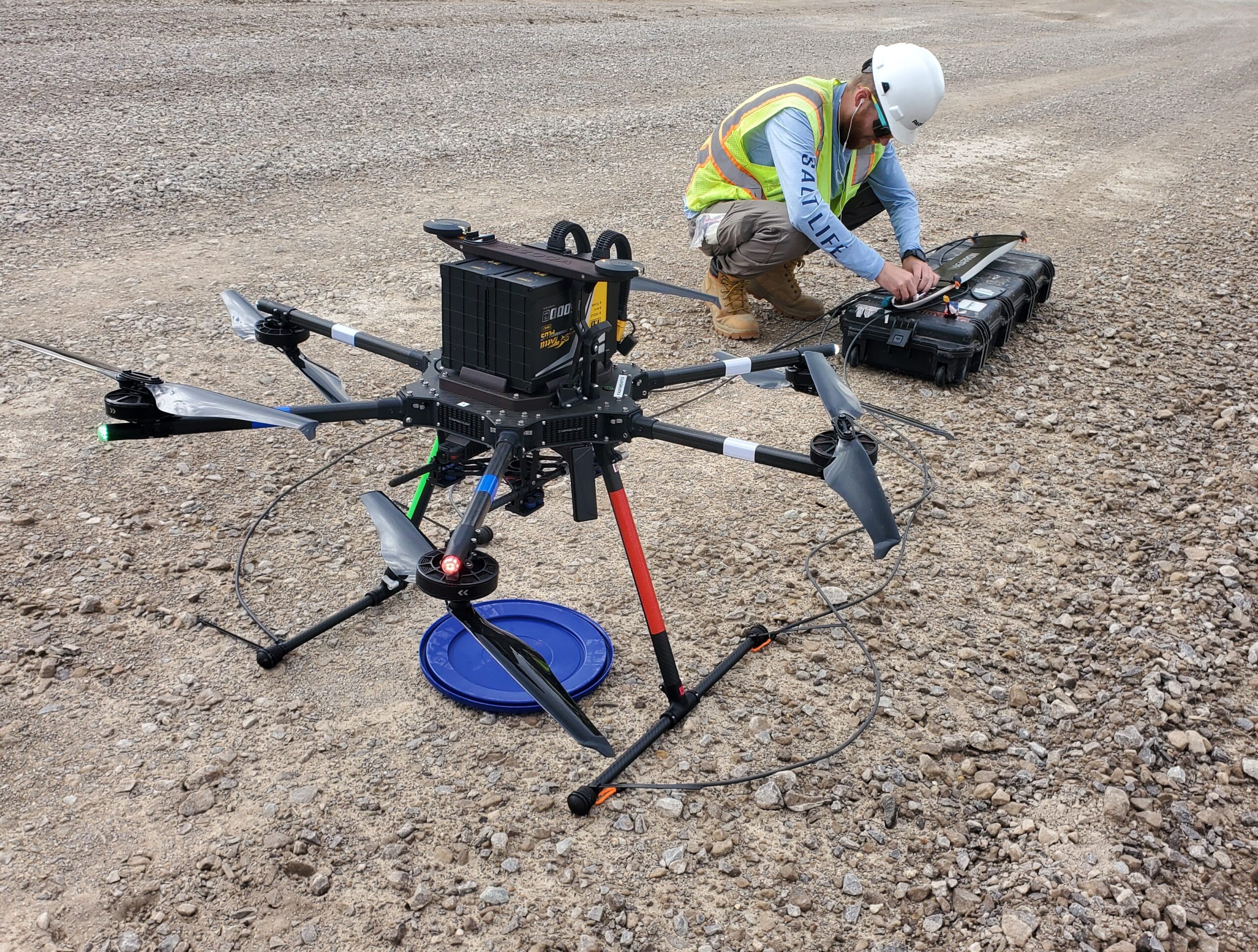
- Each drone team has varying needs and therefore, a complement of sensors including cameras, multispectral, thermal, LiDAR, and magnetometers are used.
-

- Our drone team flies in all types of locations from busy cities like New York City to the quiet forests of the midwest on many different types of projects.
Taking Project Performance To New Heights
Our extensive drone program offers our clients a myriad of safe, cost-effective solutions, including the following:
Construction Development And Monitoring
- Progress photos and videos
- Safety monitoring and inspections
- Compliance and documentation
- Photogrammetry: orthomosaics, reality modeling, clash detection, terrain mapping, schedule analysis, cut-and-fill volume calculations
- Construction-site planning
Intelligent Transportation Systems
- Traffic monitoring and analysis
- Inspections and monitoring for intelligent transportation system (ITS) assets
- 360° view assessment for equipment deployments
Maintenance Inspections
- Critical infrastructure inspections
- Bridge and tower inspections
- Change detection over time
- Oil and gas pipeline monitoring
Asset Inventory And Management
- Facility-conditions assessment
- GIS and surveying
- 3D scanning
- Automated object recognition and cataloging
Emergency Response
- Disaster management
- Scene size-up and awareness
- Damage assessments
Environmental Monitoring And Cleanup
- Orphaned well locating
- Methane detection
- Detection of UXO
- Erosion monitoring
- Water sampling and contaminant collection
- Plant health and restoration status